Using Wildfire Visualization for Mindful Communication

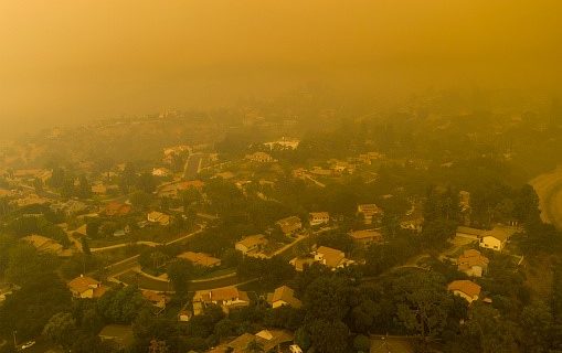
Visualizations like interactive maps, 3D videos, and virtual reality simulations are becoming popular tools for communicating with public and professional audiences about wildfire behavior and risk. Sharing information as visualizations requires careful consideration of how content might affect those who view it, particularly during and after wildfire events when the likelihood of causing or exacerbating …

Map: Southwest Fires Image (1909-2021)

Map: Most Notable Fires in Arizona and New Mexico

Explore maps of the most notable fires in Arizona and New Mexico 1909*-2021. Shown are the fires listed in our Wildfire Season Overview products as well as any fire over 100,000 acres. All of the maps are georeferenced and can be put on Avenza or a similar app to be utilized on a mobile device! *The available …

Overview and Verification of LANDFIRE Fuels: 2022 Cooks Peak Fire 

In a Nutshell: Learn more about how to use LANDFIRE. We’ll use the 2022 Cook’s Fire as a case study. Description: A practitioner-oriented overview of LANDFIRE with a focus on fuels and how they react to modeling techniques. The subject area of discussion will be the 2022 Cooks Peak fire located in northern New Mexico. This webinar will …

Land Use Planning as a Strategy for Fire Adapted Communities

Presenter: Molly Mowery, AICP, Executive Director, Community Wildfire Planning CenterDate: August 26, 2021 11am AZ/12pm MDT As communities across the U.S. face increasing threats from wildfire, there is also a growing interest in land use planning as a strategy to reduce risk and foster more resilient outcomes. Land use planning provides a variety of tools, …

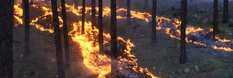
Healthy low-burning fire weaves underneath trees like a river of liquid gold.

Prescribed Fires & Fire Regimes

Presenter: Dr. Molly Hunter, USGS SW Climate Adaptation Science Center, Research Manager / Joint Fire Science Program, Science AdvisorDate: January 28, 2021 12pm MST Prescribed fire can result in significant benefits to ecosystems and society. Examples include improved wildlife habitat, enhanced biodiversity, reduced threat of destructive wildfire, and enhanced ecosystem resilience. Prescribed fire can also …

Risk Management Prioritization

Presenter: Dr Melanie Colavito, Ecological Restoration InstituteDate: December 8, 2020 12pm Mountain Time The Ecological Restoration Institute recently completed a project analyzing the use and adoption of wildfire risk assessment and fuels treatment prioritization methods and products—broadly referred to here as decision support tools (DSTs)—by federal land managers. There is a need to demystify the …

Southwest FireCLIME

Southwest FireCLIME is a multi-year research partnership between scientists and resource managers to synthesize current knowledge of regional climate-fire-ecosystem dynamics. Our project has addressed this goal through science synthesis, an annotated bibliography, modeling, a vulnerability assessment, and Fire-Climate adaptation tools. For more information, visit the website: https://swfireclime.org/ Funded by the Joint Fire Science Program, research …

May 5, 2020: Adaptation strategies for climate and fire in the Southwest

Presenters: Martha Sample and Andi Thode, Northern Arizona UniversityDate: May 5, 2020 12pm AZ/1pm MDT We will be presenting recent work on a Fire-Climate Adaptation ‘menu’ of strategies and approaches that can be used to align fire-specific management goals with climate impacts. The strategies that we have developed fit neatly into an existing climate adaptation framework …

Southwest Fire Season 2019 Overview and 2020 Outlook

Date: April 29, 2020 11am AZ/12pm MDT Presenters: Michael Lynch and Zander Evans, Forest Stewards Guild and Rich Naden, Fire Weather Meteorologist, Southwest Coordination Center The purpose of this webinar is to review 2019 fires and look ahead toward conditions for 2020. Dr. Zander Evans will present an overview of the largest fires in the …